Last updated March 1st, 2025
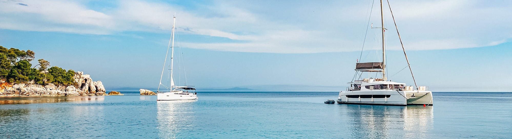
If you are looking for a detailed itinerary for planning and organizing your yacht charter sailing holiday in Croatia, specifically in the Split area, look no further. We have covered some of the best anchorage spots, mooring buoy fields, restaurants with free moorings, ports, and marinas—complete with a detailed map.
For each location, you will find a comprehensive description, safety and weather tips, insights, and local information. All of this information is provided by the professional local team at Sails of Croatia, complimentary to all sailors.
We hope you find this guide helpful and that you have a wonderful and safe sailing experience in our beautiful country.
We have focused here on the Split, Croatia region, covering:
Note: Not all anchorages, marinas, and ports are covered in this post—there are many more for you to explore and discover on your own. Be sure to use proper maps and tools while doing so, and always respect local maritime rules.
*Below the map, you can find a detailed description for each spot. Safety and weather tips, insights, and local information included.
"For mooring buoy fields, restaurants, ports, and marinas, you will find links / phone numbers for reservations. It is best to reserve a spot two to three days in advance, especially during the high season. Be sure to plan your itinerary according to the weather conditions for the week, choosing the right spot for overnight protection."
Thanks to the deeply indented coastline, Split region and its islands offer numerous peaceful and secluded anchorages. After a delightful day of sailing, drop an anchor and immerse yourself in the untouched beauty of nature and the crystal-clear waters of the Adriatic Sea.
In most bays, anchoring is permitted and free of charge. However, fees may apply if you anchor within an area where a commercial organization holds a concession issued by the Croatian authorities.
Please find below the detailed description and information of 40 Anchorage spots in Split, Croatia:
1. Kasjuni beach anchorage
Coordinates: 43.50629 N, 16.3954 E
Sea bed: Sand and Sea grass
Wind Protection: Protected from N, NE
Anchoring ground at a depth of 8-12m, sand and sea grass. Beautiful, narrow, rugged beach with gravel and rocks. Unfortunately also popular with party boats (specially during high season), so not completely quiet. On the east side there is a beach Lounge & Bar, FKK beach in the middle to west side (where the rocks are).
2. Racetinovac bay anchorage
Coordinates: 43.49361 N, 16.23597 E
Sea bed: Sand and Sea grass
Wind Protection: Protected from NE, E, SE, S, SW
Anchoring ground at a depth of 6-10m, sand and sea grass. Very protected bay with space for several boats. Very clean and crystal clear water for a good swim. Notice: Protected from NE only if anchored completely inside.
3. Fumija island anchorage
Coordinates: 43.48194 N, 16.23208 E
Sea bed: Sand
Wind Protection: Protected from NE, E, S
Anchoring ground at a depth of 6-10m, sand. Excellent daytime anchorage, beautiful location and many boats arrive during the day. Fairly busy channel, so waves often come in. Beware of wind changes, with anticyclone weather expect wind from W, NW in the afternoon hours (bay completely open to W, NW winds).
4. Blue lagoon anchorage
Coordinates: 43.4388 N, 16.17353 E
Sea bed: Sand and Sea grass
Wind Protection: Protected from NW, W
Beautiful anchoring ground at a depth of 8-14m, sand and sea grass. Crystal clear waters ideal for snorkeling, can be very crowded. Caution: A cable runs along the west side of the bay, anchoring is prohibited there.
5. Stari Trogir bay anchorage
Coordinates: 43.48636 N, 16.03802 E
Sea bed: Sand
Wind Protection: Protected from N, NE, E, SE, S
Anchoring ground at a depth of 6-14m, sand. A beautiful spot with clear water, expect to be crowded during high season.
6. Islands in front of Maslinica (marina Martinis Marchi) anchorage
Coordinates: 43.39991 N, 16.19793 E
Sea bed: Sand and Rocks
Wind Protection: Protected from E, SE
Anchoring ground at a depth of 6-14m, sand and rocks. A lot of traffic and completely open to waves, anchoring ground is not holding the best. Recommended for a swim stop during a calm day, can be used for overnight anchoring with really, really calm conditions.
7. Necujam bay anchorage
Coordinates: 43.38775 N, 16.32069 E
Sea bed: Sand and Sea grass
Wind Protection: Protected from SE, S, SW, W, NW
Anchoring ground at a depth of 6-14m, sand and sea grass. Very well protected and safe bay, the anchor holds very good in sandy bottom. Possibility to swing anchor in the middle of the bay, mostly Med mooring anchoring (secured by lines at the stern on land and anchor at the front). Very busy bay especially on first day and last day of charter in Croatia (Saturday and Thursday).
8. Gornja Krusica bay anchorage
Coordinates: 43.35724 N, 16.36703 E
Sea bed: Sand
Wind Protection: Protected from S, SW, W, NW
Anchoring ground at a depth of 6-12m, sand. Provides good holding for a day or night stop but may experience some waves due to traffic in the Solta-Brac channel, including ferries and the high-speed catamaran line between Split and Dubrovnik.
9. Stracinska bay anchorage
Coordinates: 43.33836 N, 16.36521 E
Sea bed: Sand and Rocks
Wind Protection: Protected from W, NW, N, NE, E
Anchoring ground at a depth of 6-14m, sand. Very nice bay for a quiet night and good swimming, can be crowded during the high season especially on first day and last day of charter in Croatia (Saturday and Thursday).
10. In front of Bobovisce bay (inside are buoys) anchorage
Coordinates: 43.35429 N, 16.45648 E
Sea bed: Sand
Wind Protection: Protected from NE, E, SE, S
Anchoring ground at a depth of 6-14m, sand. Wonderful anchorage, close to town, easily reachable with dinghy. Beautiful sunset view.
11. Zavrace bay anchorage
Coordinates: 43.32447 N, 16.42654 E
Sea bed: Sand and Sea grass
Wind Protection: Protected from SE, S, SW
Anchoring ground at a depth of 6-14m, sand and sea grass. Many anchoring spots, can be crowded. Be aware or thunderstorms coming from the west, completely open. Good for overnights stay or day swimming.
12. Lovrecina beach anchorage
Coordinates: 43.37147 N, 16.66637 E
Sea bed: Sand
Wind Protection: Protected from SE, S, SW
Anchoring ground at a depth of 6-14m, sand. Beautiful anchorage bay with sandy bottom, sandy beach and beach bar. Very busy with day-tripper boats during the day but quiet at night.
13. Luka bay anchorage
Coordinates: 43.34186 N, 16.79882 E
Sea bed: Sand and Sea grass
Wind Protection: Protected from S, SW, W, NW, N
Anchoring ground at a depth of 6-14m, with sand and sea grass. Inside, there are buoys, and anchoring is possible at around 8 meters of depth between the red and yellow buoys. Med mooring is available further outside the buoy fields.
14. Smrka bay anchorage
Coordinates: 43.29155 N, 16.49474 E
Sea bed: Sand
Wind Protection: Protected from W, NW, N, NE, E
Anchoring ground at a depth of 8-14m, with sand. Swing anchoring is possible in front of the submarine tunnel. The bay is well-sheltered, offering good holding in the sand. Med mooring is available on the east side, across from the submarine cave.
15. Blaca bay anchorage
Coordinates: 43.27603 N, 16.51583 E
Sea bed: Sand and Rocks
Wind Protection: Protected from NW, N, NE
Anchoring ground at a depth of 10-14m, consisting of sand and rocks. A beautiful anchorage bay, with a monastery located a 30-minute walk away.
16. Nedomisalj anchorage
Coordinates: 43.21356 N, 16.57021 E
Sea bed: Sand
Wind Protection: Protected from S, SW, W, NW
Anchoring ground at a depth of 10-14m, with sand. A beautiful bay with a sandy bottom. The layer of sand is not thick everywhere, so dig in the anchor to be sure that it is holding.
17. Vlaska bay anchorage
Coordinates: 43.22545 N, 16.54793 E
Sea bed: Sand
Wind Protection: Protected from E, SE, S, SW
Anchoring ground at a depth of 8-14m, with sand. Beautiful anchorage with enough space for swing anchoring and Med mooring anchoring.
18. Island Zecevo anchorage
Coordinates: 43.18916 N, 16.69216 E
Sea bed: Sand and Rocks
Wind Protection: Protected from NW, N, NE
Anchoring ground at a depth of 8-14m, with sand and rocks. Buoys from a beach bar are located inside, with anchoring better situated further outside. Ideal for a swim stop, but overnight stays are recommended only in calm weather conditions.
19. In front of Vrboska anchorage
Coordinates: 43.17889 N, 16.69309 E
Sea bed: Sand
Wind Protection: Protected from NW, N, NE
Anchoring ground at a depth of 8-14m, with sand. Beautiful anchorage with space for many boats.
20. Ondra's beach anchorage
Coordinates: 43.20072 N, 16.52888 E
Sea bed: Sand, Sea grass and Rocks
Wind Protection: Protected from SE, S, SE, W
Anchoring ground at a depth of 8-14m, with sand. Beautiful anchorage mostly for Med mooring anchorage option.
21. Zukova bay anchorage
Coordinates: 43.20895 N, 16.58199 E
Sea bed: Sand and Rocks
Wind Protection: Protected from SE, S, SW, W, NW
Anchoring ground at a depth of 10-16m, with sand and rocks. The ground is a good mixture of sand and rocks, bit deeper. Recommended for a swim stop. For overnight stay only with calm conditions.
22. Bay Luka Soline anchorage
Coordinates: 43.1579 N, 16.366 E
Sea bed: Sea grass
Wind Protection: Protected from N, NE, E, SE
Wide anchoring ground at a depth of 8-14m, with sea grass. The ground is full of sea grass and the anchor is not holding the best here. Recommended for day / overnight stay only with calm conditions.
23. Tarsce bay anchorage
Coordinates: 43.15892 N, 16.37446 E
Sea bed: Sand and Sea grass
Wind Protection: Protected from W, NW, N, NE, E
Anchoring ground at a depth of 8-14m, with sand sea grass. Very busy anchorage especially at the high season time. Mostly for Med mooring anchoring, with enough space for some boats to swing anchor outside.
24. Vis Submarine tunnel anchorage
Coordinates: 43.07749 N, 16.18132 E
Sea bed: Sand and Sea grass
Wind Protection: Protected from S. SW, W, NW, N
Anchoring ground at a depth of 8-14m, with sand and sea grass. Anchoring ground in front of a submarine tunnel, can get busy during the day. At the end of the day, most boat leaves the spot and can be a nice overnight stay.
25. In front of Stoncica bay #1 (buoys inside) anchorage
Coordinates: 43.07296 N, 16.2397 E
Sea bed: Sand and Rocks
Wind Protection: Protected from S. SW, W, NW
Anchoring ground at a depth of 10-14m, with sand and rocks. Anchoring ground not holding the best, recommended only in calm conditions.
26. In front of Stoncica bay #2 (buoys inside) anchorage
Coordinates: 43.07025 N, 16.24129 E
Sea bed: Sand and Rocks
Wind Protection: Protected from S. SW, W
Anchoring ground at a depth of 10-14m, with sand and rocks. Same as the previous spot, anchoring ground not holding the best, recommended only in calm conditions. Mostly for Med mooring anchoring here.
27. Ruda bay anchorage
Coordinates: 43.02215 N, 16.19826 E
Sea bed: Sand and Rocks
Wind Protection: Protected from W, NW, N, NE, E
Anchoring ground at a depth of 8-14m, with sand and rocks. Beautiful and peaceful anchoring spot, almost empty for overnight stays. Mostly for Med mooring anchoring, no cell signal. Perfect to get away from everyday life.
28. Porat, Bisevo anchorage
Coordinates: 42.98227 N, 16.0026 E
Sea bed: Sand and Sea grass
Wind Protection: Protected from NW, N, NE, E, SE, S
Anchoring ground at a depth of 6-12m, with sand and sea grass. A beautiful bay that cannot accommodate many boats and can get crowded. Amazing sunset views and a beach with restaurants. If anchored on sea grass, beware - your anchor may drift.
29. Tufera, Scedro anchorage
Coordinates: 43.09384 N, 16.67075 E
Sea bed: Sand and Sea grass
Wind Protection: Protected from E, SE, S
Anchoring ground at a depth of 8-14m, with sand and rocks. A beautiful and peaceful bay, even in high season can happen that you are a single boat inside (depends on luck of the day).
30. Porterusa, Scedro anchorage
Coordinates: 43.08274 N, 16.71737 E
Sea bed: Sand
Wind Protection: Protected from W, NW, N, NE, E
Anchoring ground at a depth of 8-14m, with sand. A beautiful and peaceful bay, with spots only for a few boats. Med mooring anchor, be aware of rats that want to became a boat guests occasionally.
31. Prznjak anchorage
Coordinates: 42.90597 N, 16.69271 E
Sea bed: Sand, Sea grass and Rocks
Wind Protection: Protected from NW, E, SE, S
Anchoring ground at a depth of 8-14m, with sand, sea grass and rocks. Protected bay between two islands, spots for a few boats. Islands are low and the ground is not holding to good, recommended for a day stop or overnight with calm conditions.
32. Saplun west anchorage
Coordinates: 42.78062 N, 16.98498 E
Sea bed: Sand, Sea grass and Rocks
Wind Protection: Protected from SE, S, SW
Anchoring ground at a depth of 6-14m, with sand, sea grass and rocks. Remote spot that is exposed to wind and swells if the conditions are not right. Recommended for a swim stop during the day.
33. Saplun east anchorage (buoy field also)
Coordinates: 42.7811 N, 16.98921 E
Sea bed: Sea grass
Wind Protection: Not protected (only for calm conditions)
This spot is a buoy field usually (anchoring might be possible outside the buoy field). From year to year the policy of this spot changes so we cannot say with certainty what will you encounter when you arrive there. Do not plan a late sail in to check, come in early and if you find an empty buoy it can be a good overnight stay when conditions are calm. Definitely have a plan B.
34. Beach Bilin Zal, Korcula anchorage
Coordinates: 42.92358 N, 17.18745 E
Sea bed: Sand
Wind Protection: Protected from NW, W, SW
Anchoring ground at a depth of 6-10m, with sand. Anchoring spot is in front of a sandy beach, ground is holding good. Wide anchoring spot and many boats can fit. Recommended for overnight stay in calm conditions.
35. Badija anchorage
Coordinates: 42.95011 N, 17.16056 E
Sea bed: Sand
Wind Protection: Protected from NE, N, NW (though not the best protection, as the wind funnels in).
Anchoring ground at a depth of 6-10m, with sand. The anchoring spot is in front of a monastery. On the island, you will encounter reindeer roaming around. Walk around the island to see beautiful greenery, rocks, and beaches. A large anchoring spot with space for many boats.
36. Kneza bay anchorage
Coordinates: 42.97544 N, 17.04525 E
Sea bed: Sand, Sea grass and Rocks
Wind Protection: Protected from S, SW, W, NW, N
Anchoring ground at a depth of 6-10m, with sand, sea grass and rocks. Wide anchoring spot for many boats. Be aware that the anchoring ground does not provide the best holding; it is recommended for a swim stop during the day and overnight stays only in calm conditions.
Notice: The port authority sometimes charges for anchoring here. Be cautious of local fraud-ask for a concession and proper paperwork when paying; otherwise, you might end up paying twice. A fiscalized invoice must be issued to you.
37. Beach Punta anchorage
Coordinates: 43.00663 N, 17.01553 E
Sea bed: Sand and Sea grass
Wind Protection: Protected from E, SE, S, SW
Anchoring ground at a depth of 6-12m, with sand and sea grass. Remote and beautiful anchoring spot.
38. Cesminova bay anchorage
Coordinates: 43.03707 N, 17.01415 E
Sea bed: Sand
Wind Protection: Protected from NE, E, SE, S
Anchoring ground at a depth of 6-10m, with sand. Remote and beautiful anchoring spot.
39. Forgotten tribe anchorage
Coordinates: 43.04111 N, 17.01215 E
Sea bed: Sand
Wind Protection: Protected from NE, E, SE, S
Anchoring ground at a depth of 6-10m, with sand. Remote and very beautiful anchoring spot. You need to visit this one - colors are magnificent on a sunny day!
40. Lastovo Submarine tunnel anchorage
Coordinates: 42.75829 N, 16.81441 E
Sea bed: Sand
Wind Protection: Protected from S, SW, W, NW, N
Anchoring ground at a depth of 10-14m, with sand. Plenty of room for the several yachts. Submarine tunnel that you can moor up to as well. National park Lastovo fee will be charger for this anchoring spot.
Buoy over anchor. In many regions, anchor-friendly bays have been transformed into buoy fields to preserve underwater flora. While this eliminates the need for anchoring, buoy fields come with their own set of advantages.
A buoy is definitely a safer option than an anchor, especially for overnight stays in semi-harsh to harsh weather conditions. In Croatia, mooring buoys are attached to massive concrete blocks (usually weighing one to three tons) that securely hold your boat. They are well-maintained and in good condition.
The cost of using a mooring buoy in Croatia ranges from €40 to €140, depending on the location's popularity and the size of your yacht.
There are different options, including swing buoys and line-to-shore buoy fields. Below, we provide detailed information on each buoy field.
Once you're secured, take a moment to inspect the buoy and assess its condition. Just like an anchor check, if possible a quick dive can be beneficial. How is the buoy fastened to the seabed? What state is the chain/mooring line in? Has the line been damaged by another boat's propeller? A quick inspection is always worthwhile. No one wants to rely on a damaged buoy when the strong wind starts howling!
Please find below the detailed description and information of 13 Mooring Buoy fields in Split, Croatia:
1. Buoy field Bobovisca
Coordinates: 43.3522 N, 16.45884 E
Wind Protection: Protected from all winds
Buoy field Bobovisca offers protection from all winds. Here you will find a north bay and a south bay buoy field. Both are mooring buoy to bow and mooring at the stern. Mooring assistance is provided. The small town is easily accessible by dinghy, there is a small supermarket and two restaurants. The buoys are very close to each other, almost marina feeling with the boat distances.
Reservation: Possible at the number +385915001619
2. Buoy field Luka bay
Coordinates: 43.33879 N, 16.79928 E
Wind Protection: Protected from all winds
Buoy field Luka offers protection from all winds. Here you will find red and yellow buoys, yellow ones are better protection from N and NW while red ones are better protection from NE, E and SE. Both red and yellow are swing buoys. Mooring assistance is provided. Remote and beautiful spots with two restaurants in the bay. Be sure to ask while reserving if it is possible to reserve just a buoy, as the restaurants tend to prioritize boats with customers dining in the restaurant.
Reservation: Red buoys at the number +38598867292, Yellow buoys at the number +38598781358
3. Buoy field Bol
Coordinates: 43.26088 N, 16.65873 E
Wind Protection: Open to all winds
Buoy field Bol does not offer protection from winds and is recommended only with calm conditions. Mooring buoys are healthy and they will hold the yacht, but with semi strong to strong winds you will have a rope squeaking noise all night. In addition it is open to ferry waves that pass in the Hvar - Brac channel. Excellent party stop with a beautiful beach Zlatni rat on the west, nice walking or take a street train from Bol to the beach.
Reservation: Not possible
4. Buoy field Primosten
Coordinates: 43.58385 N, 15.92537 E
Wind Protection: Protected from NW, N, NE, E, SE
Buoy field Primosten offers protection from almost all winds. Be aware that with strong SE you will have some winds and swell inside. Buoy field in front of town harbour, mooring assistance is provided. In town you can find everything from markets, restaurants, bakeries etc.
Reservation: Possible at the number +385959120721
5. Buoy field Vinogradisce (Palmizana beach)
Coordinates: 43.15772 N, 16.39 E
Wind Protection: Protected from W, NW, N, NE, E
Buoy field Vingradisce is a beautiful but very popular spot. Many party boats during the day taking the guests to Laganini bar. During the night it is usually calm, but can happen that you have a party boat beside. Speed taxi can take you to the town of Hvar, they will approach you during your stay (be sure to negotiate the price). Because of it's popularity this is an expensive buoy field, you can ask the prices over the phone.
Reservation: Possible at the number +385911718242
6. Buoy field Hvar town
Coordinates: 43.17035 N, 16.43889 E
Wind Protection: Protected from NW, N, NE
Buoy field Hvar town is a busy and very popular spot. A lot of daily traffic from day tours, ferries and private yachts. In 2024 most of the buoys were replaced with a floating dock on the west side, There were only a few swing buoys left to use inside. On the east side is a peer of town Hvar (mostly preserved). Buoys and floating dock is a first come - first serve policy.
Reservation: Not possible
7. Buoy field Stoncica
Coordinates: 43.06753 N, 16.24293 E
Wind Protection: Protected from E, SE, S, SW, W, NW
Buoy field Stoncica town is a beautiful and peaceful spot. There is a sandy beach on the shore with a restaurant. Excellent spot for families with kids and anyone who loves a cold drink with sand under your feet. During the day boats come in only for a short stay, so be sure to ask other captains are they staying for the night or moving - you can anchor outside and wait until a buoy gets free.
Reservation: Not possible
8. Buoy field Vis town
Coordinates: 43.06042 N, 16.19173 E
Wind Protection: Protected from N, NE*, E, SE, S, SW, W, NW
Buoy field Vis town town is a large and busy spot, offering many buoys for safe mooring to accommodate numerous boats. On the west side, between the ferry pier and the diesel station, you can find protection from NE* wind. The rest of the buoys provide shelter from all other wind directions. Depending on the weather forecast, choose a buoy in the most protected area for the winds of the day. The town offers a variety of restaurants, markets, bakeries, open market, and more. Mooring follows a first-come, first-served policy. Be aware that during the high season, the buoys tend to fill up completely between 2 and 3 PM. Some of the buoys are extremely close to each other, make sure to choose a buoy with enough space from other boats and one that is suitable for your yacht’s size.
Reservation: Not possible
9. Buoy field Komiza town
Coordinates: 43.04574 N, 16.08247 E
Wind Protection: Protected from NW, N, NE, E, SE
Buoy field Komiza town town is a beautiful spot. Buoy field is spread out from west to east side of the bay. Recommendation is to catch a buoy on the west side where the diving center and the rocks are for a more peaceful night (even though a dingy ride to town is bit further away). Protected from SE winds, but can create small waves - with stronger SE winds recommendation is to be closer to town itself. The town offers a variety of restaurants, markets, bakeries, open market, and more. Mooring follows a first-come, first-served policy. Be aware that during the high season, the buoys tend to fill up completely between 2 and 3 PM. Some of the buoys are extremely close to each other, make sure to choose a buoy with enough space from other boats and one that is suitable for your yacht’s size.
Reservation: Not possible
10. Buoy field Blue cave
Coordinates: 42.98271 N, 16.02056 E
Wind Protection: Protected from SW, W, NW, N
Buoy field Blue cave is a popular spot, used for short stay during the day to visit the Blue cave. Buoys are not charged, you will pay for the entry fee tickets to the Blue cave. Organized with the Blue cave port authority shuttle dinghy will pick you up and will take you into the Blue cave for a wonderful experience. Best time to visit the Blue cave is from 10am till noon. Some buoys are close by, be sure to try and catch the one that is suitable for your yacht size.
Reservation: Not possible
11. Buoy field Gradina
Coordinates: 42.97223 N, 16.67342 E
Wind Protection: Protected from N, NE, E, SE
Buoy field Gradina is a beautiful spot. Very nice and friendly bay, crystal clear turquoise water with well-spaced buoys. Anchoring possible beside buoy field, anchoring will be charged by port authority - not the best anchoring spot.
Reservation: Not possible
12. Buoy field Lastovo Nature Park - Zaklopatica
Coordinates: 42.77397 N, 16.87531 E
Wind Protection: Protected from E, SE, S, SW, W, NW, N
The buoy field in Zaklopatica is a well-protected spot. The buoy field is located on the north side of the bay, closer to the small island. Some of the buoys are close to each other, so make sure to choose one with enough space from other boats and one that is suitable for your yacht’s size. Nature park rangers will charge both a nature park fee and a buoy field fee. In the bays, there are numerous restaurants that offer free mooring if you dine there (see the description under the 'restaurants with free mooring' section). There’s a short dinghy shuttle to shore and a 40-minute walk uphill to the beautiful village of Lastovo. Amazing sunset! Be aware that the mistral (NW wind) funnels in quite harshly during the day, so exercise caution during the mooring procedure.
Reservation: Not possible
13. Buoy field Scedro
Coordinates: 43.09198 N, 16.69889 E
Wind Protection: Protected from E, SE, S, SW, W, NW, N
The buoy field Scedro is a beautiful and well protected spot. Here you will find a lot of buoys to fit many boats. Mooring assistance is provided. Remote and beautiful spots with restaurants in the bay. Be sure to make the reservation at least one-two days in advance, especially in the high season.
Reservation: Possible at the number +385976308141
Restaurants with free moorings are a great option if you wish to have a safe overnight stay and try some fantastic local cuisine. Most of the restaurants offer free mooring when you dine there. Some of the most beautiful bays in Croatia are under restaurant concessions and are definitely worth visiting. Enjoy a peaceful night under the stars and a morning swim in the beautiful turquoise waters. Most of the restaurant mooring buoys are well placed, offering a greater distance from other yachts and more privacy during your stay.
Below, we provide detailed information on each restaurant spot, along with a phone number for reservations. Be sure to make the reservation two to three days in advance (especially during the high season).
Please find below the detailed description and information of 18 Restaurants with free mooring in Split, Croatia:
1. Konoba Sesula Mooring buoys
Coordinates: 43.39357 N, 16.21005 E
Wind Protection: Protected from NW, N, NE, E, SE
Restaurant / Konoba Sesula offers free buoys in a beautiful and well protected bay. Very busy spot especially on first day and last day of charter in Croatia (Saturday and Thursday). Mooring assistance is provided.
Reservation: Possible at the number +3859915575927
2. Lonely Paradise Mooring buoys
Coordinates: 43.3709 N, 16.28845 E
Wind Protection: Protected from W, NW, N, NE, E
Restaurant Lonely Paradise offers free buoys in a beautiful and remote bay Tatinja on south side of island Solta. Very busy spot especially on first day and last day of charter in Croatia (Saturday and Thursday). Mooring assistance is provided. In season 2024 sometimes they charged separately for the buoy in the range of 20,00 to 40,00 EUR. Be sure to ask over the phone if they are charging the buoy separately. Definitely a spot worth visiting if you are planning a dinner in the restaurant.
Reservation: Possible at the number +3859914532010
3. Lero restaurant Mooring buoys
Coordinates: 43.36662 N, 16.29348 E
Wind Protection: Protected from W, NW, N, NE, E
Restaurant Lero offers free buoys in the beautiful Jorja bay on the south side of the island of Solta. It’s a busy spot, especially on the first and last days of charters in Croatia (Saturday and Thursday). Mooring buoy at the bow and a shore line at the stern. Mooring assistance is provided. A very beautiful spot with cliffs, but the signal can be weak.
Reservation: Possible at the number +385922053460
4. Pasarela restaurant Mooring buoys & Dock
Coordinates: 43.39387 N, 16.3016 E
Wind Protection: Protected from E, SE, S, SW, W, NW
Restaurant Pasarela offers free buoys or dock in the bay Rogac on the north side of the island of Solta. It’s a ferry spot for Solta island, from the dock of the restaurant you are hidden and do not have the view on the ferry spot but more on the beautiful nature. Busy spot, especially on the first and last days of charters in Croatia (Saturday and Thursday). Mooring assistance is provided.
Reservation: Possible at the number +38521654505
5. Konoba Sveti Petar Mooring buoys
Coordinates: 43.39162 N, 16.32589 E
Wind Protection: Protected from NE, E, SE, S, SW
Restaurant Sveti Petar offers free buoys in the entrance of bay Necujam on the north side of the island of Solta. Busy spot, especially on the first and last days of charters in Croatia (Saturday and Thursday). Mooring assistance is provided. Some buoys are close to each other.
Reservation: Possible at the number +385916019872
6. Konoba Family Mooring buoys
Coordinates: 43.31077 N, 16.44445 E
Wind Protection: Protected from SW, W, NW. N NE, E
Restaurant Family offers free buoys in the bay of Lucice on the south side of the island Brac. Beautiful spot to spend the night. Mooring assistance is provided.
Reservation: Possible at the number +385916195198
7. Konoba Rojen - Rade Mooring buoys & Dock
Coordinates: 43.33856 N, 16.79752 E
Wind Protection: Protected from E, SE, S, SW, W, NW, N
Restaurant Konoba Rojen offers buoys and dock in the bay of Luka near Povlja on the north side of the island Brac. Beautiful and remote spot to spend the night. Mooring assistance is provided. Nice walk up the hill with a beautiful sunrise view.
Reservation: Possible at the number +38598867292
8. Vala Hrvatska restaurant Mooring buoys
Coordinates: 43.26214 N, 16.78521 E
Wind Protection: Open to all winds
Vala Hrvatska Restaurant offers buoys, it is located on the south side of the island Brac. Beautiful and remote spot to stop for lunch or spend the night. Opened to all winds and all traffic in the Brac - Hvar channel. Can get a bit choppy, recommended in calm weather conditions.
Reservation: Possible at the number +385913660976
9. Veli Dolac restaurant Mooring buoys
Coordinates: 43.21869 N, 16.55633 E
Wind Protection: Protected from W, NW, N, NE, E
Veli Dolac Restaurant offers buoys, it is located in the bay Tiha on the north side of the island Brac. Well protected and beautiful spot to spend the night.
Reservation: Possible at the number +38598222950
10. Tiha Lounge bar Mooring buoys
Coordinates: 43.2134 N, 16.54478 E
Wind Protection: Protected from NW, N, NE
Tiha Lounge bar offers buoys, it is located in the entrance of bay Tiha on the north side of the island Brac. Great stop for lunch, be sure to ask if they are preparing dinners as they are mostly a day stop location. Can get busy during the day, possible to have lunch and to stay overnight on the buoy. Not so well protected, recommended in calm weather conditions.
Reservation: Possible at the number +385989282090
11. The FisherMan's House restaurant - Sveti Klement
Coordinates: 43.16729 N, 16.36728 E
Wind Protection: Protected from E, SE, S, SW
The FisherMan's House restaurant offers buoys, it is located on the north side of the Pakleni islands. Great stop for a local domestic first class fish menu.
Reservation: Possible at the number +38598727186
12. Mamato bar Mooring buoys
Coordinates: 43.15798 N, 16.4168 E
Wind Protection: Protected from E, SE, S, SW, W, NW
Mamato bar offers buoys, it is located in the east passage of the Pakleni islands. Very busy passage during the day, bay with many restaurants with buoys. Mamato is our recommendation as it is not as popular and is located more inside of the traffic.
Reservation: Possible at the number +385917930542
13. Restaurants in Zaklopatica with peer (restaurants: Santor, Augusta Insula, Triton, Aragosta)
Coordinates: 42.7734 N, 16.87723 E
Wind Protection: Protected from E, SE, S, SW, W, NW, N
Restaurants in Zaklopatica, NP Lastovo offers free dock. Most of the restaurants have electricity and water included in the service. Bear in mind that the electricity is usually during the day while the restaurant is working. Water can be limited if there are water restrictions on the island. Make sure to check this while calling for a reservation.
Reservation: Possible at the number +385953803363 (Santor), +38598571884 (Augusta Insula), +385917313122 (Triton), +385915311074 (Aragosta)
14. Konoba Porto Rosso - floating pontoon (Not free mooring)
Coordinates: 42.73427 N, 16.88619 E
Wind Protection: Protected from all winds
Konoba Porto Rosso offers mooring on a floating pontoon, which is not free of charge. Electricity and water are included; however, please bear in mind that electricity is usually available only during the day while the restaurant is operating. Water may be limited if there are water restrictions on the island. In addition to the mooring fee, you will also need to pay the Nature Park Lastovo ticket to the park rangers.
Reservation: Possible at the number +38520801261 (Marina), +385989813797 (Restaurant)
15. Estravaganca restaurant Mooring buoys
Coordinates: 43.00097 N, 17.03657 E
Wind Protection: Protected from NE, E
Estravaganca restaurant offers free buoys, it is located in the north side of Peljesac peninsula in the Peljecas - Korcula channel. You might get some waves from the ferries and yachts in the channel. Very nice and remote spot.
Reservation: Possible at the number +385989447099
16. Gambo restaurant Mooring buoys
Coordinates: 43.11564 N, 17.09886 E
Wind Protection: Protected from W, NW, N, NE, E
Gambo restaurant offers free buoys, it is located in the south east side of island Hvar. Beautiful and remote spot with fantastic atmosphere and delicious food.
Reservation: Possible at the number +385977172381
17. Moster restaurant Mooring buoys (Not free mooring)
Coordinates: 43.09401 N, 16.70745 E
Wind Protection: Protected from E, SE, S, SW, W
Moster restaurant is located in the north side of island Scedro. Beautiful and remote spot, unfortunately the restaurant does not have their own free buoys anymore.
Reservation: Possible at the number +385989236040
18. Konoba Mareta Mooring buoys
Coordinates: 43.18391 N, 16.40588 E
Wind Protection: Protected from S, SW, W, NW, N, NE, E
Konoba Mareta offers free buoys. It is located on the southwest side of the island of Hvar, in the bay of Vela Garska. A beautiful and remote spot with crystal-clear water, perfect for swimming and rock jumping. On land, the deer come down to the restaurant and the beach in the late afternoon.
Reservation: Possible at the number +385917968396
There are several reasons why opting for a marina in Croatia might be a better choice than anchoring a yacht, depending on your preferences and the circumstances:
Safety and Security: Marinas provide a more secure environment for your yacht, especially in busy or popular areas. With mooring lines and often 24/7 security, you'll have peace of mind knowing your yacht is safe.
Amenities and Services: Marinas typically offer a wide range of services that can make your stay more comfortable, such as water and electricity hookups, Wi-Fi, laundry, and waste disposal. Additionally, many marinas have restaurants, shops, and even repair services, making them convenient for provisioning and maintenance.
Protection from Weather: While anchoring can provide a sense of freedom, marinas offer protection from strong winds, waves, and storms. This can be especially valuable during stormy weather or when conditions are unpredictable.
Convenience and Accessibility: Marinas are usually located close to the town center or key tourist attractions, making it easy to explore the area on foot. If you're planning to visit local landmarks or dine out, being docked in a marina means you won't need to use tenders or dinghies to get to shore.
Below, we provide detailed information on each marina and port in Split area, along with a phone number or link for reservations. Be sure to make the reservation two to three days in advance (especially during the high season).
Please find below the detailed description and information of 28 Marinas and Ports in Split, Croatia:
1. Marina Trogir (ex.SCT)
Coordinates: 43.51341 N, 16.24413 E
Wind Protection: Protected from all winds and waves
Marina Trogir is located within walking distance of the UNESCO-listed town of Trogir. This marina is a starting point for charters in Croatia, so it is very busy on Fridays and Saturdays. It is recommended to visit from Sunday to Thursday to explore and visit Trogir city. Marina is quite wide and safe to dock.
Services available: Electricity, Water, Showers, Restrooms, Market, Restaurant & Bar
Reservation: Possible at link https://marina21.com/en/marina-trogir/#booking
VHF channel: 17
2. Marina Kastela
Coordinates: 43.54558 N, 16.40125 E
Wind Protection: Protected from all winds and waves
Marina Kastela is located in Kastel Gomilica. This marina is a starting point for charters in Croatia, so it is very busy on Fridays and Saturdays. Marina is quite wide and safe to dock. Taxi drive (30 min) to Trogir or Split city.
Services available: Electricity, Water, Showers, Restrooms, Market, Restaurant & Bar
Reservation: Possible at link https://marina-kastela.hr/en/transit-berth-inquiry/
VHF channel: 17
3. Marina Aci Split
Coordinates: 43.50245 N, 16.43098 E
Wind Protection: Protected from all winds and waves
Marina Aci Split is located in Split town itself (10 min walk to old town). This marina is a starting point for charters in Croatia, so it is very busy on Fridays and Saturdays. It is recommended to visit from Sunday to Thursday to explore and visit Split city. Marina is quite narrow and can be tricky to dock.
Services available: Electricity, Water, Showers, Restrooms, Market, Restaurant & Bar
Reservation: Possible at link https://booking.aci-club.hr/en/
VHF channel: 17
4. Marina Agana
Coordinates: 43.51254 N, 16.11358 E
Wind Protection: Protected from all winds and waves
Marina Agana is located in Marina town, 20 min drive from Trogir city. This marina is a starting point for charters in Croatia, so it is very busy on Fridays and Saturdays. It is recommended to visit from Sunday to Thursday. Marina is quite narrow and can be tricky to dock.
Services available: Electricity, Water, Showers, Restrooms, Market, Restaurant & Bar
Reservation: Possible at link https://www.marina-agana.hr/en/contact-us
VHF channel: 17
5. Marina Frapa Rogoznica
Coordinates: 43.53018 N, 15.96352 E
Wind Protection: Protected from all winds and waves
Marina Frapa is located in town Rogoznica. This marina is a starting point for charters in Croatia, so it is very busy on Fridays and Saturdays. It is recommended to visit from Sunday to Thursday to explore and visit Rogoznica city. Marina is quite narrow and can be tricky to dock.
Services available: Electricity, Water, Showers, Restrooms, Market, Restaurant & Bar
Reservation: Possible at link https://www.marinafrapa.hr/en/rogoznica/marina/sea-berth-reservation
VHF channel: 11
6. Marina Kremik
Coordinates: 43.5702 N, 15.94038 E
Wind Protection: Protected from all winds and waves
Marina Kremik is located between the town of Primosten and Rogoznica. This marina is a starting point for charters in Croatia, so it is very busy on Fridays and Saturdays. It is recommended to visit from Sunday to Thursday. Taxi transfer can be organized from marina Kremik to visit Primosten town.
Services available: Electricity, Water, Showers, Restrooms, Market, Restaurant & Bar
Reservation: Possible at link https://marina-kremik.com/contact-location/
VHF channel: 17
7. Primosten town
Coordinates: 43.58557 N, 15.92342 E
Wind Protection: Protected from all winds and waves
Primosten town offers safe moorings. Busy and noisy spot as the moorings are quite close to resturants and bars. Be aware that with strong SE you will have some winds and swell inside.
Services available: Electricity, Water, Showers, Restrooms, Market, Restaurant & Bar
Reservation: No official reservation. You can try on number +385915222800
8. Marina Martinis Marchi
Coordinates: 43.39799 N, 16.20539 E
Wind Protection: Protected from all winds and waves
Marina Martinis Marchi is a safe and beautiful marina on Solta island. Be aware that with strong NW & W winds, there may be swell inside. There are mooring spots on the outside of the breakwater that are not recommended during strong NW & W winds.
Services available: Electricity, Water, Showers, Restrooms, Market, Restaurant & Bar
Reservation: Possible at link https://www.martinis-marchi.com/marina
VHF channel: 17
9. Luka Rogac
Coordinates: 43.39571 N, 16.29876 E
Wind Protection: Protected from all winds and waves
Luka Rogac is a safe port on north side of Solta island. It is located just beside ferry point and a diesel station. Recommended only to hide from bad weather situations.
Services available: Electricity, Water, small market, Restaurant & Bar
Reservation: No official reservation. First come, first serve policy.
10. Stomorska port
Coordinates: 43.37111 N, 16.35265 E
Wind Protection: Protected from all winds (NE will bring some swell inside).
Stomorska port is a safe port on north side of Solta island. Beautiful little town worth a visit.
Services available: Electricity, Water, small market, Restaurant & Bar
Reservation: No official reservation. First come, first serve policy.
11. Bobovisca port
Coordinates: 43.35058 N, 16.4629 E
Wind Protection: Protected from all winds and waves
Bobovisca port is a safe port on the west side of Brac Island. It's a beautiful spot with a nice walk for a stunning sunset. It has two restaurants, a small market, and a bar. Definitely worth visiting.
Services available: Electricity, Water, small market, Restaurant & Bar
Reservation: Possible at the number +385915001619
12. Marina Vlaska Milna
Coordinates: 43.32933 N, 16.43935 E
Wind Protection: Protected from all winds and waves
Marina Vlaska Milna is a safe port on the west side of Brač Island, right at the entrance to Milna town. It offers a pleasant, green setting and is a 15-20 minute walk along the Milna waterfront to the town itself. It's quieter than the marinas in the town and offers an easy dinghy shuttle to the markets in the town.
Services available: Electricity, Water, Showers, Restrooms, Markets in town, Restaurant & Bar
Reservation: Possible at link https://marinavlaska.eu/booking/
VHF channel: 17
13. Marina Kanarija Milna
Coordinates: 43.32731 N, 16.44396 E
Wind Protection: Protected from all winds and waves
Marina Kanarija Milna is a safe port on the west side of Brač Island. Marina itself is located on the south side of the Milna bay, just after passing the diesel station.
Services available: Electricity, Water, Showers, Restrooms, Market, Restaurant & Bar
Reservation: Possible at the number +385953765001
14. Marina Aci Milna
Coordinates: 43.32659 N, 16.44772 E
Wind Protection: Protected from all winds and waves
Marina Aci Milna is a safe port on the west side of Brač Island. Marina itself is located inside the Milna town itself. Very vibrant and sometimes noisy.
Services available: Electricity, Water, Showers, Restrooms, Market, Restaurant & Bar
Reservation: Possible at link https://booking.aci-club.hr/en/
VHF channel: 17
15. Pucisca port
Coordinates: 43.34817 N, 16.7334 E
Wind Protection: Protected from all winds and waves
Pucisca port is a safe harbor on the north side of Brač Island. It’s a stunning place, so don’t be put off by the quarry on the approach. The town of Pucisca is built entirely from white limestone from Brač Island. Definitely worth a visit.
Services available: Electricity, Water, Market, Restaurant & Bar
Reservation: Possible at the number +385921387422
16. Bol port and dock
Coordinates: 43.2613 N, 16.6589 E
Wind Protection: Very opened and not protected from winds and waves
Bol town is a nice place located on the south side of Brač Island. Port is bit more protected that the dock on the east side of the town. Recommended only in calm weather conditions. Be aware that you will get waves in from the traffic in the Brac - Hvar channel, make sure to tighten up the mooring lines with engine power and stay as far as you can from the dock with the stern. Excellent party stop with a beautiful beach Zlatni rat on the west, nice walking or take a street train from Bol to the beach.
Services available: Electricity, Water, Market, Restaurant & Bar
Reservation: No official reservation. First come, first serve policy.
VHF channel: 9
17. Starigrad town
Coordinates: 43.18454 N, 16.5947 E
Wind Protection: Protected from all winds and waves
Starigrad town is a beautiful town located on the north west center side of Hvar Island. Very well protected and one of the most beautiful towns in Split sailing region. Starigrad is one of the oldest towns in Croatia, with a history that dates back to Greek and Roman times. Beautiful spot to wander the streets and have a unique insight on Roman and Greek times. There are moorings on the north and south sides of the town: the north side is better protected from north winds and much easier to dock with strong NE winds.
Services available: Electricity, Water, Showers, Restrooms, Market, Restaurant & Bar
Reservation: No official reservation. First come, first serve policy.
VHF channel: 9
18. Marina Aci Vrboska
Coordinates: 43.17914 N, 16.67552 E
Wind Protection: Protected from all winds and waves
Marina Aci Vroska is a safe marina located on the north east center side of Hvar Island. Very nice and quiet marina in front of Vrboska town.
Services available: Electricity, Water, Showers, Restrooms, Market, Restaurant & Bar
Reservation: Possible at link https://booking.aci-club.hr/en/
VHF channel: 17
19. Jelsa town
Coordinates: 43.16234 N, 16.69413 E
Wind Protection: Protected from all winds and waves except NE
Jelsa is a beautiful town located on the northern-central side of Hvar Island. It is a picturesque town with charming streets to explore. Moorings are available on both the north and south sides of the town. Due to the landscape, winds are more likely to come from the sides when docking.
Services available: Electricity, Water, Showers, Restrooms, Market, Restaurant & Bar
Reservation: No official reservation. First come, first serve policy. You can try on number +385913106235
VHF channel: 9
20. Marina Aci Palmizana
Coordinates: 43.16222 N, 16.39404 E
Wind Protection: Protected from all winds and waves
Marina Aci Palmizana is a beautiful marina located on Pakleni islands. It can be more lively as it is a popular spot for party boats to dock and take speed boat taxi to Hvar town. Nice walk from the marina to the south side of the island to Palmizana beach. Narrow marina and can be tricky to dock, depending on the spot.
Services available: Electricity, Water, Showers, Restrooms, Small Market, Restaurant & Bar
Reservation: Possible at link https://booking.aci-club.hr/en/
VHF channel: 17
21. Hvar town
Coordinates: 43.17134 N, 16.44085 E
Wind Protection: Protected from all winds and waves except strong NW & W winds that can bring some swell inside.
Hvar Town is a very popular and busy spot, with a lot of traffic and waves from yachts and ferries going in and out. On the inside east dock, you are a bit more protected from the waves. This area is mostly reserved for superyachts, but there’s a chance to get a spot on less busy days. On the west side, there are pontoons available for docking.
Services available: Electricity, Water, Market, Restaurants & Bars
Reservation: No official reservation. First come, first serve policy. You can try on number +38521717282
VHF channel: 9
22. Vis town
Coordinates: 43.05961 N, 16.18763 E
Wind Protection: Protected from all winds and waves except N & NE winds
Vis Town is a beautiful and lively spot located in a large, naturally protected bay (Bay of Saint George) on the northeastern side of the island of Vis. It serves as a turning point for the Split sailing region, and its busiest days are from Monday to Wednesday. During the high season, be sure to arrive early to secure a spot. Be aware that you may experience waves from the ferry entering the port, so make sure to tighten the mooring lines using engine power and keep the stern as far from the dock as possible. Water restrictions may apply, so make sure to ask the peer officer if there are any time limitations for refilling the water
Services available: Electricity, Water, Showers, Restrooms, Market, Restaurants & Bars
Reservation: No official reservation. First come, first serve policy. You can try on number +385912277551
23. Kut - Vis
Coordinates: 43.05915 N, 16.19818 E
Wind Protection: Protected from all winds and waves except NW, N & NE winds
Kut - Vis is the part of Vis town on the very east end. Same as Vis town it serves as a turning point for the Split sailing region, and its busiest days are from Monday to Wednesday. During the high season, be sure to arrive early to secure a spot. Be aware that you may experience waves from the ferry entering the port, so make sure to tighten the mooring lines using engine power and keep the stern as far from the dock as possible. Water restrictions may apply so make sure to ask the peer officer if there are any. Better protected from SE winds that the Vis town itself.
Services available: Electricity, Water, Showers, Restrooms, Market, Restaurants & Bars
Reservation: No official reservation. First come, first serve policy. You can try on number +38521711007
VHF channel: 9
24. Komiza town
Coordinates: 43.04472 N, 16.08683 E
Wind Protection: Protected from all winds and waves
Komiza is a charming town located on the western side of Vis Island, Croatia. Known for its picturesque setting, this historic fishing village offers a more tranquil and traditional experience compared to the busier town of Vis, situated on the eastern side of the island. The town is nestled in a sheltered bay, surrounded by dramatic cliffs and crystal-clear waters, making it a perfect spot for boaters and visitors who enjoy natural beauty. The narrow, cobblestone streets, whitewashed houses, and vibrant squares contribute to its timeless Mediterranean atmosphere.
Services available: Electricity, Water, Showers, Restrooms, Market, Restaurants & Bars
Reservation: No official reservation. First come, first serve policy.
VHF channel: 9
25. Marina Korkyra Vela Luka
Coordinates: 42.96034 N, 16.71189 E
Wind Protection: Protected from all winds and waves except NW & W winds
Marina Korkyra Vela Luka is located on the western side of Korcula Island, Croatia. Some swell can occur during strong NW and W winds. Best is to reserve a spot inside of the marina to be better protected from the swell.
Services available: Electricity, Water, Showers, Restrooms, Market, Restaurants & Bars
Reservation: Possible at link https://marina21.com/en/marina-korkyra/#booking
VHF channel: 17
26. Marina Aci Korcula
Coordinates: 42.95834 N, 17.13704 E
Wind Protection: Protected from all winds and waves
Marina Aci Korcula is located on the eastern side of Korcula Island, Croatia. This marina is located in the town of Korcula itself. It serves as a turning point for the Split and Dubrovnik sailing region, and its busiest days are from Monday to Wednesday. Be sure to make the reservation several days in advance. Narrow marina and can be tricky to dock, depending on the spot.
Services available: Electricity, Water, Showers, Restrooms, Market, Restaurants & Bars
Reservation: Possible at link https://booking.aci-club.hr/en/
VHF channel: 17
27. Trpanj port
Coordinates: 43.00947 N, 17.26642 E
Wind Protection: Protected from all winds and waves
Trpanj port is located on the north side of the Pelješac Peninsula, Croatia. It's a beautiful place with a nice seafront walking area to the east of the town. On the west side, you'll find Tuna Bar Trpanj, an excellent dinner option. Although it is protected by a breakwater from the west, strong NW and W winds can make docking more difficult, as they will hit from the side. As it is not on the standard charter route, this beautiful spot can be empty even during the high season.
Services available: Electricity, Water, Market, Restaurants & Bars
Reservation: No official reservation. First come, first serve policy. You can try on number +385998015106
28. Sucuraj
Coordinates: 43.12499 N, 17.18915 E
Wind Protection: Protected from all winds and waves except SE & E winds
Sucuraj is located on the east side of the Hvar island, Croatia. Nice little marina with very friendly service. Eastern ferry point of island Hvar.
Services available: Electricity, Water, Showers, Restrooms, Market, Restaurants & Bars
Reservation: No official reservation. First come, first serve policy. You can try on number +385989692765 or +385915201017
VHF channel: 10

Anchoring in Croatia Guide | How to anchor your Yacht

Best time to Sail Croatia

Sailing weather in Croatia
We hope this blog post will help you in creating your perfect and safe sailing itinerary in Split region, Croatia. With its stunning coastline, beautiful islands, and clear waters, Croatia offers an unforgettable sailing experience. Whether you're an experienced sailor or a newcomer, this guide is designed to assist you in planning a smooth and enjoyable journey. Wishing you safe travels and many incredible adventures on the Adriatic!
*Even though this information is double-checked, we always love to improve and would be happy to hear if you have something to add or if you think anything needs to be changed in this blog post. Be sure to write to us at info@sailsofcroatia.com
Written by Siniša Bartolin, Sails of Croatia
More from Sailing Croatia blog and news

Sailing Croatia | Sunreef Catamarans for Charter in Croatia

Luxury Sailing Croatia – Exclusive Yacht Charter Experience

Boat Hire Croatia | Sailing Croatia

Best places to sail in Croatia

Rent a Boat Croatia | Sailing Croatia


